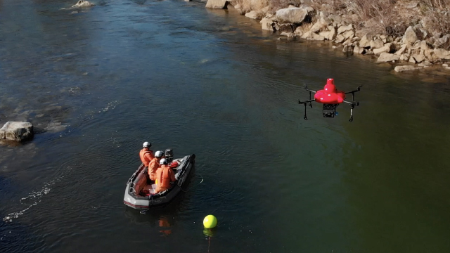
With the increasing popularity of leisure activities in river areas, mountain trekking, and swimming, not only severe climate-related accidents are occurring.
Search and rescue by drones not only enables us to locate victims as soon as possible, but also to give quick rescue orders and understand the disaster situation by information from the sky.

Public Safety / Security
The information obtained from the air using drones provides a more accurate picture of the scene. It has helped to dramatically increase the effectiveness of search and rescue missions.

Logistics
While the volume of logistics is increasing due to the expansion of online shopping, a new logistics system is needed. In addition, even in times of disaster, such as typhoons and earthquakes, the need for rapid and smooth logistics in emergencies is becoming increasingly important. Inter-island logistics, transporting goods to isolated disaster areas, transporting goods to mountainous construction sites, etc. We propose a new logistics system that utilizes the sky for quantity and quality.
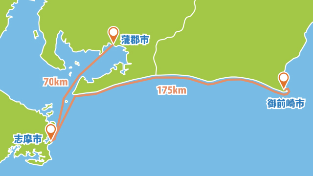
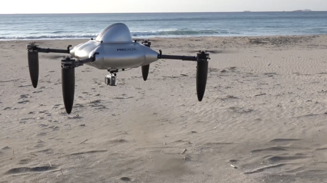
We have already developed a long-distance logistics drone connecting 175 km in the Tokai area. The PDH-GS120 is a gasoline powered helicopter type drone with 10kg payload and 2 hours flight time capabilities. And the PD6B-Type2 can carry maximum payload of 30kg, which is useful for short-range logistics available. We will propose a drone system tailored to your needs based on our many years of experience.

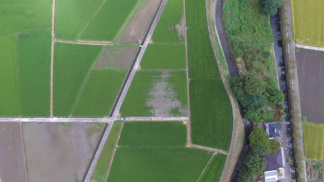
Agriculture
Accurate data collection and precise responses are needed for precision agriculture, such as field surveying, growth and moisture surveys, pesticide application management and yield forecasting. The more accurate data you get from the sky, the more efficient for your smart farming.
The SkymatiX X-F1 is specialized in pesticide and granular spraying. It is waterproof and capable of spraying pesticides along with any terrains. Spraying on up and down hill can be done with a pre-defined autoflight plan. Using it together with the farmland management application provided by SkymatiX, you can monitor the health of the crops and maximize the yield.

Construction
The use of drones for surveying has expanded into a variety of fields such as construction, land development and mining. The performance of the drone is critical for the success in operations that require the acquisition of high-precision data and data accuracy.
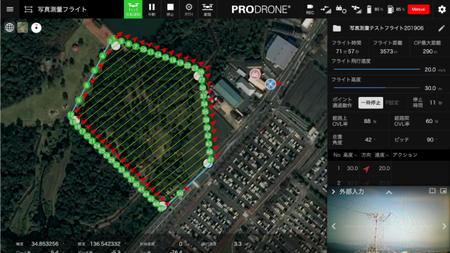
Our splendid PD6B-Type2 laser surveyor with Riegle lasers and the most advanced green laser surveyor have supported surveying operations in many sites. We cover all the essential elements of drone surveying such as high payload capacity, flight stability, original GCS overlap for surveying applications, flight path autogeneration and dispatching a professional pilot to perform the flight operations. We can meet a wide range of your surveying needs.

Insfrastructure Inspection
Infrastructure inspection includes inspection of aging bridges, highway, buildings, dams, pylons, tunnels and other structures, is essential for safety. Infrastructure inspections with drones are not only cost-saving and quick, but also allow us to carry out inspections of large size structures which has never been done.
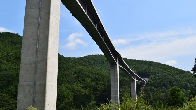
Our custom drones are used for highway and bridge inspections.
Even in spaces with unstable radio reception, such as cell towers and power towers, we achieved stable flights at many those sites.
We offer a wide range of services, from taking inspection photos with a high definition camera that boasts 100 million pixels to inspection with 4K video. We can customize our whole inspecting solutions to suit your needs.

Specisal purpose filming
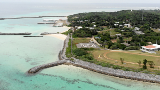
The places where drones can capture images are not only in the sky, but also in the water. The usages of drones in new applications are expanding. Surveying the condition of the sea floor, the growth of seaweed, or monitoring fish farm which was difficult to achieve before. We've also developed drones for special photography in environments where you can't see the sky, tunnels and indoors, and so on. Possibility is limitless.
Resource observations of the sea have been difficult to carry out in the past due to the high cost of chartered ships and other equipment. Our water landing drone can land on the surface of the water, and a camera installed in the lower part of the drone made it possible to observe the growth of coral and seaweed or monitor fish in the fish farm in the water.

Level3 / BVLOS
"Long-range flights are needed for various operations, such as logistics, wide-area surveillance, and search&rescue people in distress. The key to these operations is the control technology for Beyond Visual Line Of Sight (BVLOS).
Reliable communication technology and advanced sensing technology are needed to ensure safe and reliable operations in BVLOS."
We have already accumulated hundreds of BVLOS flights and developed with full safety measures, ensuring redundancy in radio frequency acquisition, battery redundancy and collision avoidance systems.