

Multi Functional GCS, Proudly Made In Japan
Highly specialized to meet market needs, original GCS for advanced auto flight.
You can easily create a variety of automated flight plans to suit your use cases, such as photogrammetry and building inspections using POI. With two external video outputs, it can easily project images on a screen in the field.
You can easily create a variety of automated flight plans to suit your use cases, such as photogrammetry and building inspections using POI. With two external video outputs, it can easily project images on a screen in the field.
Optional Accessories

LTE
Drone control over a wide area using the LTE radio network

Tethering Option
Tethering system enables for long continuous operation

BVLOS
Meets the requirements for BVLOS (Beyond Visual Line Of Sight) flight. (In Japan)
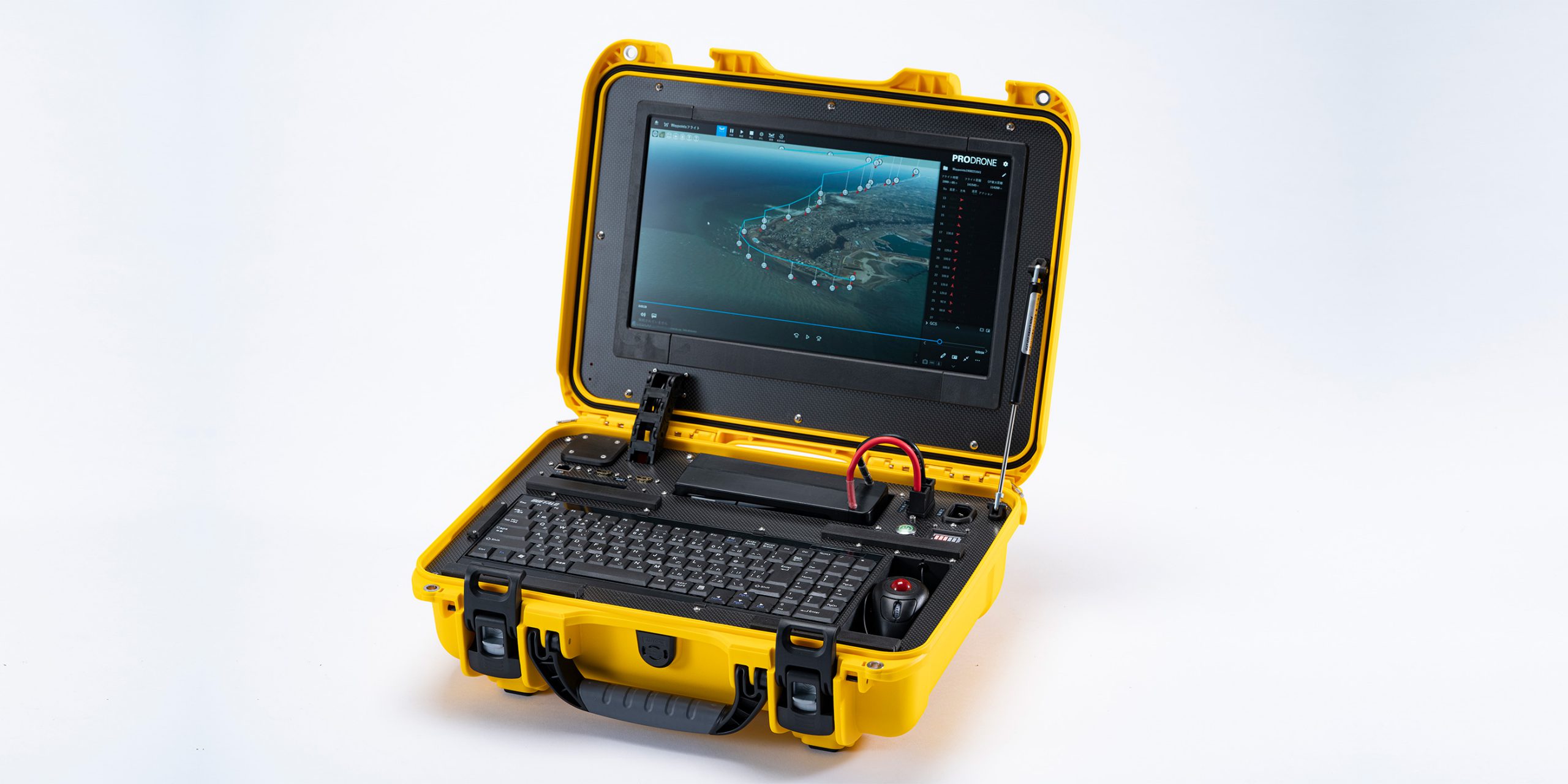
The All-In-One GCS With All The Necessary
Equipment In One Package.
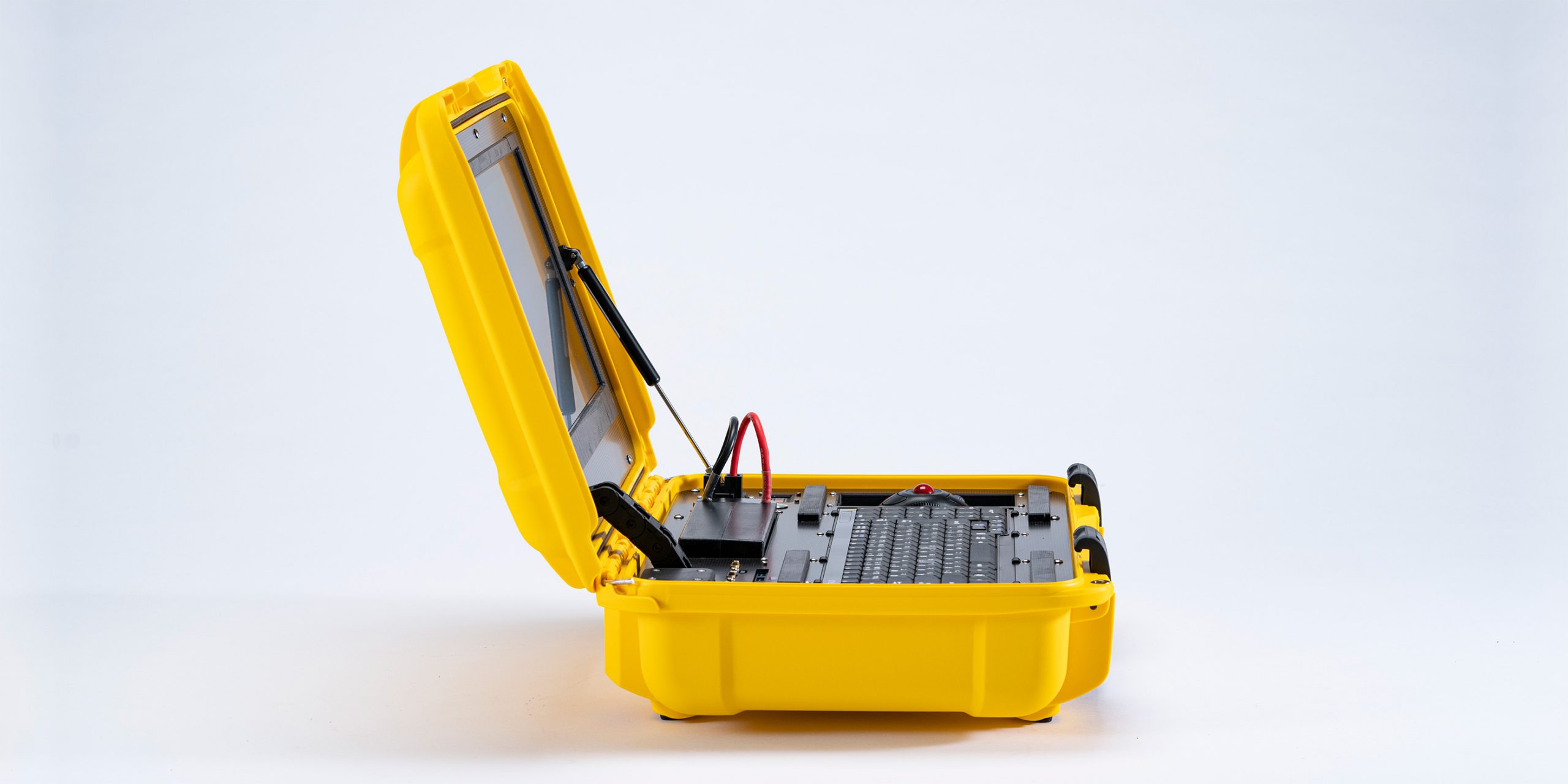
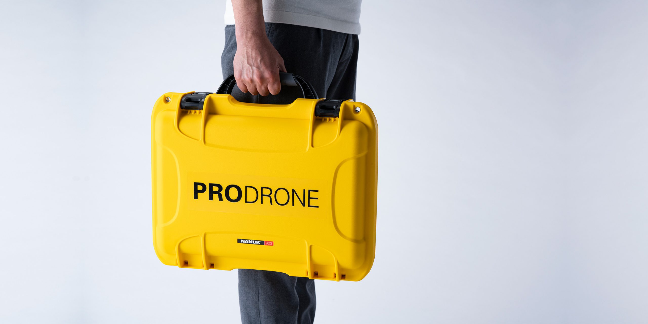
This all-in-one package is highly portable and can be deployed with a single touch.
Waterproof and dustproof rating IP65 when the case is closed.
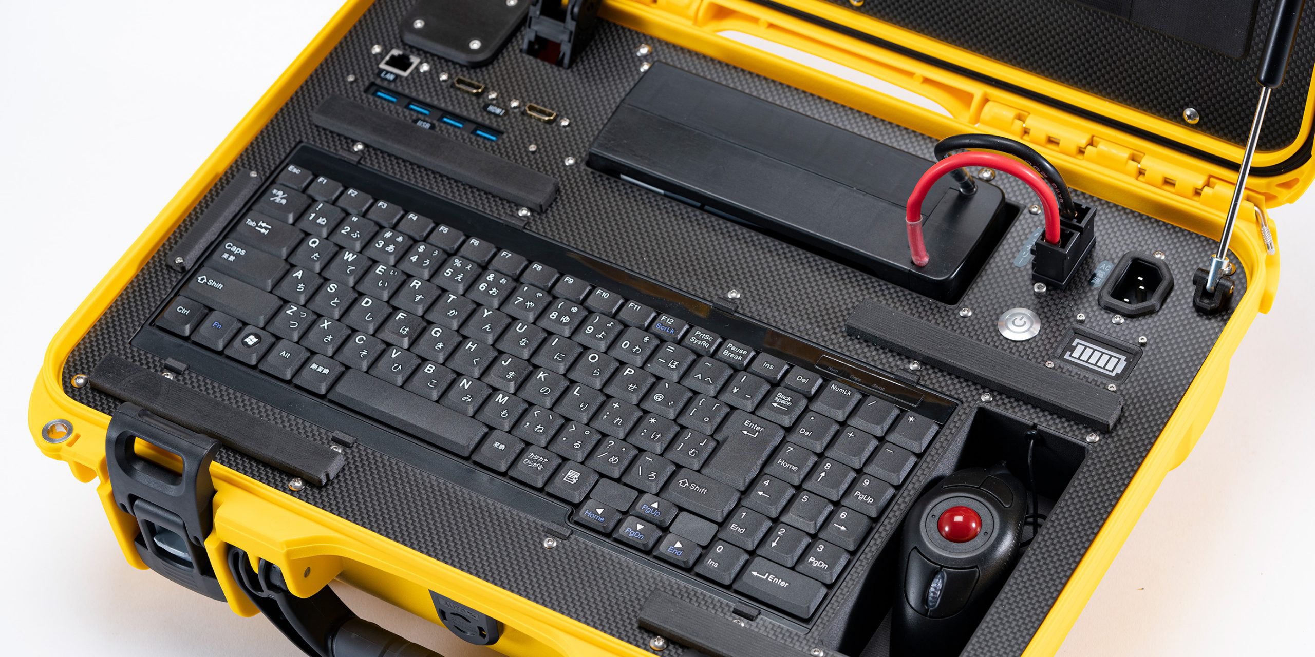
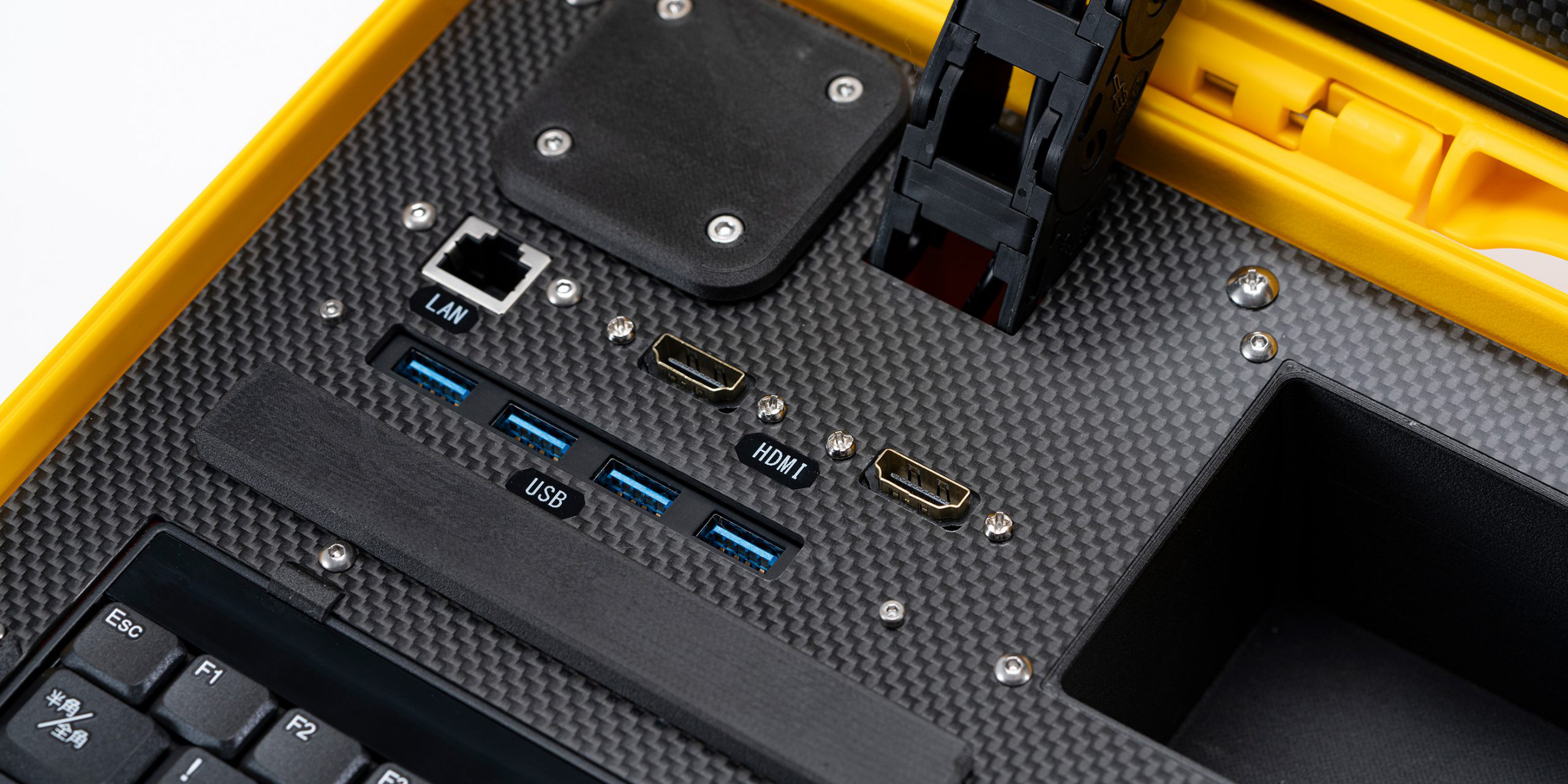
The unit is equipped with two types of outputs: an HDMI output passthrough for video transmission equipment and an HDMI output for multiple displays. These features make it easy to share information and give accurate instructions on site.
You can choose the input devices that best suit your needs by connecting 4 USB3.0 inputs.
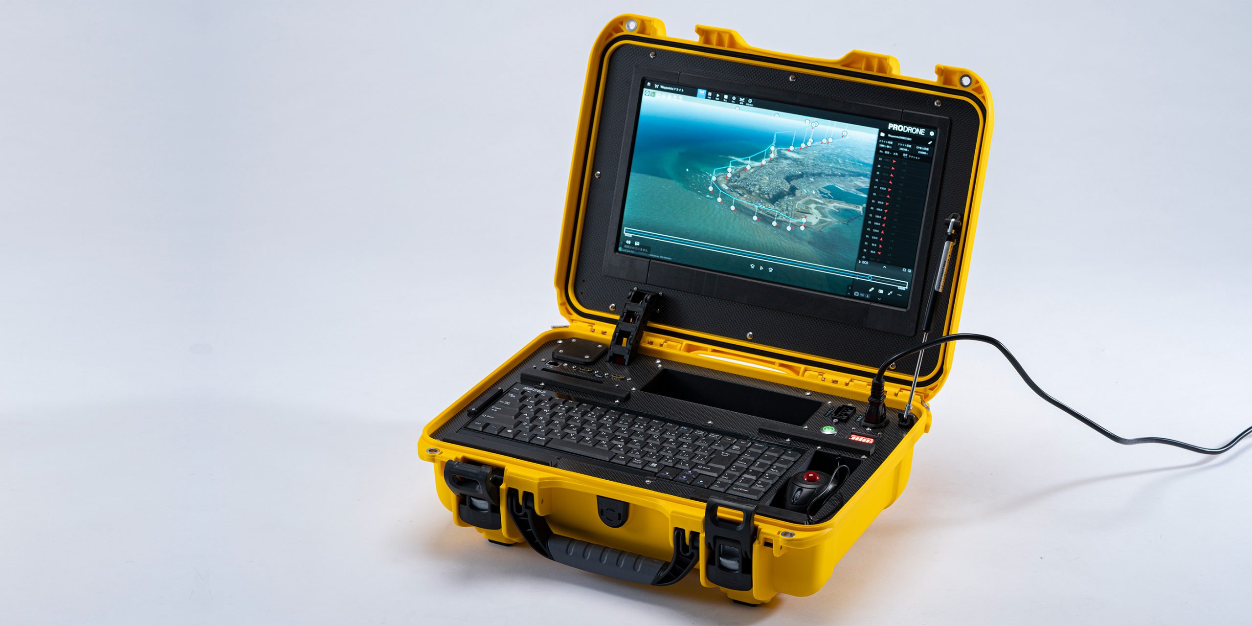
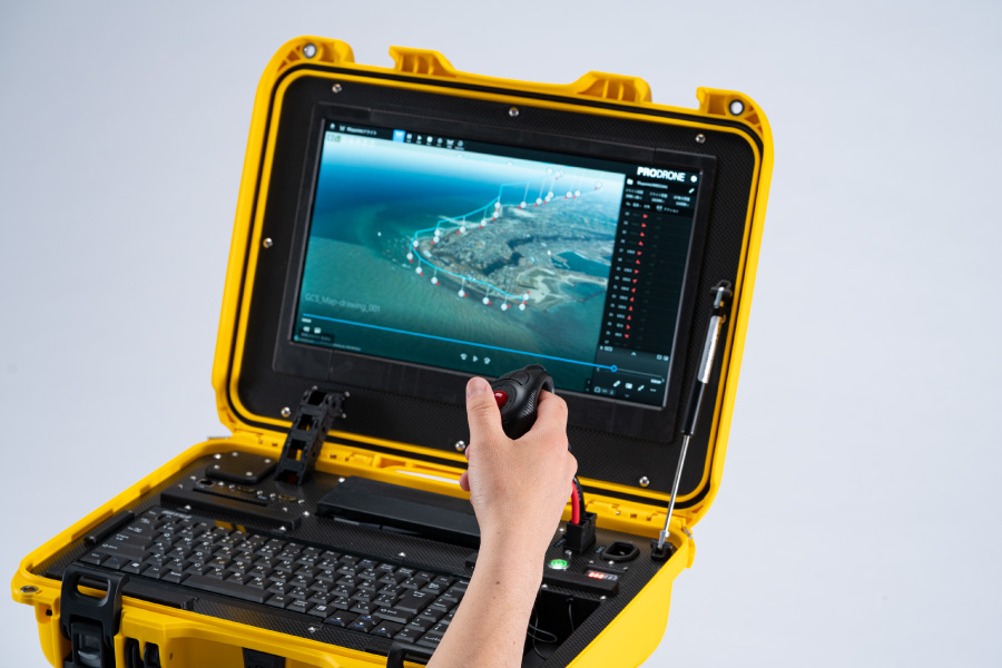
The PD-GCS monitor has a high brightness monitor display (1200cd/m2), which provides high visibility even in strong sunlight.
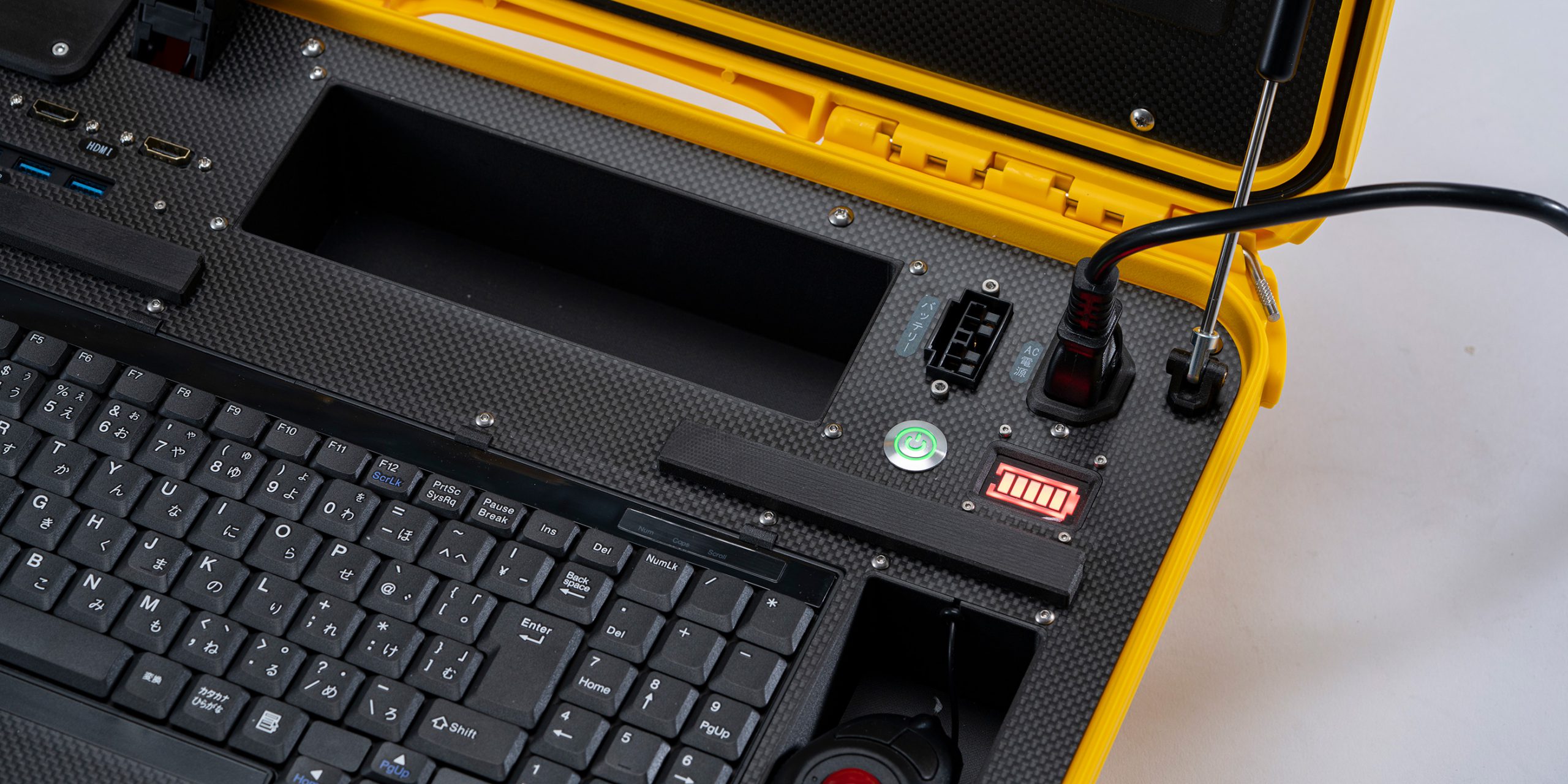
One-touch startup/shutdown for easy operation. Operation is possible with our 6-cell batteries for drones. Of course, power supply from AC100V is also possible.
Easy-To-Use UI and Customizable Screen Settings
Based on the feedback from our pilots' rich experience in the field, we have developed a user interface that is thoroughly designed for ease of use.
The screen layout can be flexibly modified according to the desired task by displaying images on the sub display and flight paths and telemetry on the main display.
It can be operated from a tablet (optional). The main unit can be operated using the standard accessory keyboard and mouse, while the tablet can be operated using the touch UI.
In addition to the display, the map display position and telemetry content can be configured for each connected tablet/PC to provide optimal information for each operator.
2D and 3D Map Display
You can easily switch between 2D mode, which displays the map as seen from above or aerial photos, and 3D mode, which displays a map reflecting elevation data, allowing you to design a flight route that suits your needs. Maps can be downloaded to the GCS and used offline (*optional).
The 2D display of maps and aerial photos enables precise horizontal route planning in logistics, surveying, agriculture, etc., where horizontal accuracy is required.
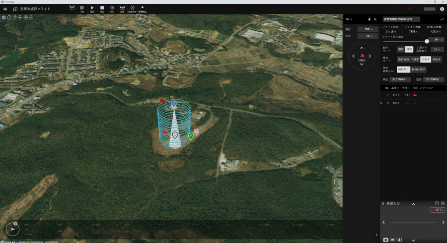
When flying along the ground surface or near structures, where flight altitude is an important factor, the 3D map allows you to design a plan intuitively.
Photogrammetric Processing At The Field
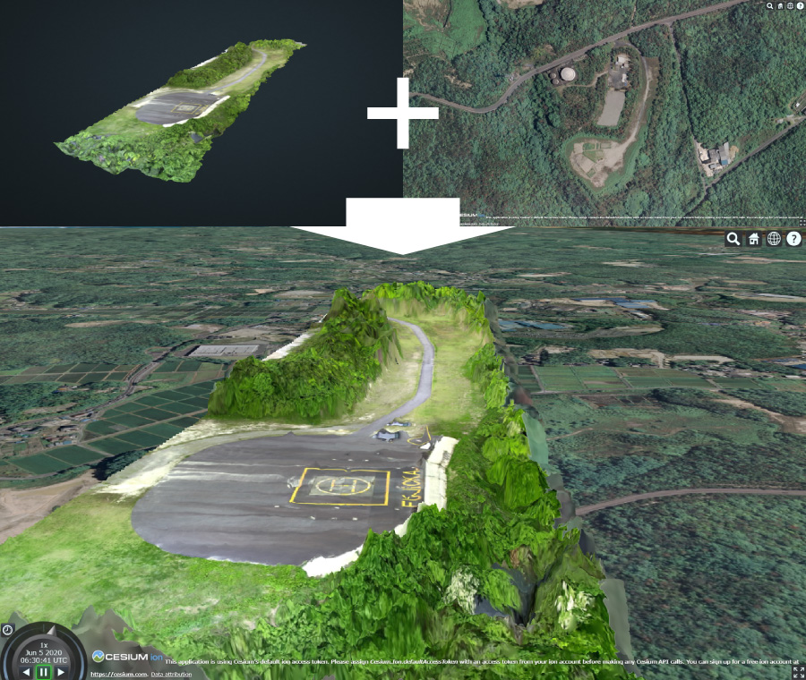
The PD-GCS can rapidly generate 3D point cloud data and ortho-images with color information from camera images.
The camera is equipped with a global shutter for high-precision imaging to improve analysis accuracy.
For example, in the case of a landslide or other site that requires a rapid response, the acquired terrain data can be combined and compared with map data from the Geospatial Information Authority of Japan (GSI) and other sources to quickly locate the disaster site.
The system can generate an accurate 3D model of the site for creating a three-dimensional flight plan tailored to your current situation.
Numerous Flight Plan Templates and Waypoint Actions
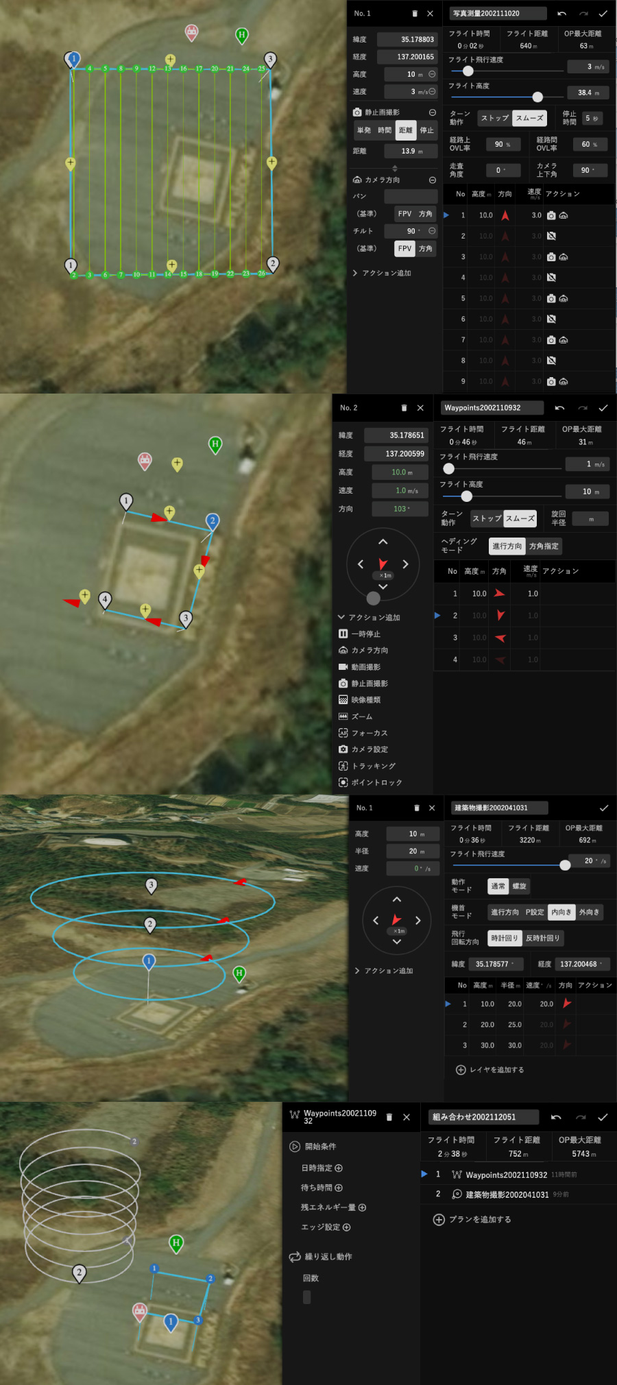
The PD-GCS bundles with extensive flight plan templates for photogrammetry, inspection, patrol, pesticide spraying, building inspection and more.
For photogrammetry flights, plans will be automatically generated based on survey area, angle of view, lap rate, etc., and also enables for automatic shutter control.
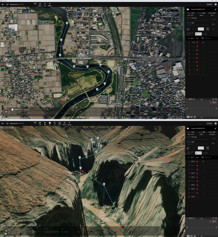
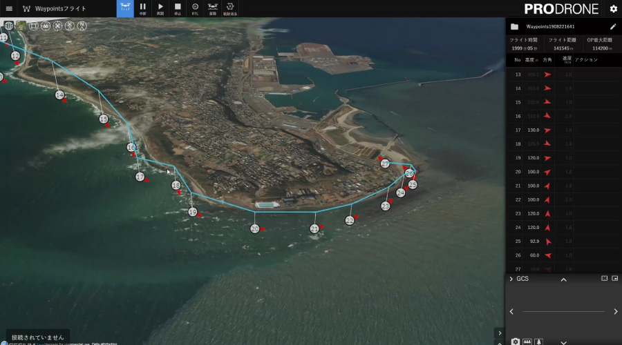
Up to 65,536 waypoints and waypoint actions can be configured for waypoint flights. At each waypoint, aircraft and payload operations can be configured. The large number of configurable points allows for long distance flights, flights along undulations, flights in complex terrain, and patrol surveillance.
Importing flight paths is available. You can design a plan to fly along the terrain from a digital elevation mesh (DEM) designed on a separate terminal, or a plan to fly according to your own building plans, which can then be imported into GCS and flown.
Waypoint actions can be configurable to do actual services such as inspections, patrol and pesticide spraying. It also supports emergency landing points (known as rally points). This function is mainly intended for long-distance flights, and multiple evacuation points can be registered in advance in the vicinity of the flight path to be evacuated in case of unforeseen circumstances.
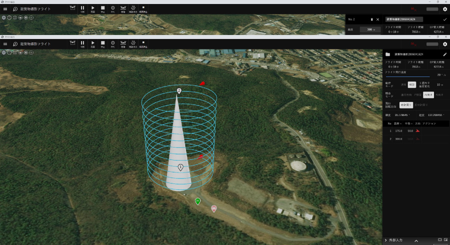
Two types of building survey flights are available: layered POI and spiral POI flights. The spiral POI flight is mainly suitable for inspection and surveying flights of radio towers, buildings, tanks, etc.
*Waypoints are points that can be set along the flight path.
In addition to automatic flight settings, you can also set up detailed actions such as camera control, gimbal control, spraying and hovering settings
Autonavigation For A Variety Of Use Cases
Various combinations of flights and repetitive flights can be set up.
It is possible to perform distant building inspections, multiple building inspections, and patrols with automatic navigation.
Extensive Reporting Menu
With the PD-GCS, the flight log can be viewed by the date and time of the flight.
Selecting the flight log displays the video and telemetry data that was flown at that time. The telemetry and video can be stored and played back synchronously.
In addition, if necessary, the user can download and retrieve the log data and video data.
The telemetry can be selected only when the video data is recorded.
| Basic Features | UI operation for each payload | Camera、Bimbal |
| Flight plan | Configurable : 65,535 Waypoints, POI, Rally Points | |
| 3D map dsiplay | ||
| Off-line map | Importable from other GIS service (option) | |
| Telemetry | Graphical Displayed | |
| Flight log | Graphical Displayed | |
| Flight log playback | Playback video and telemetry of designated date and time. | |
| Options | Gaming pad ※Optional | Support for external steering with the game stick (No radio controller configuration) |
| Tablet ※Optional |
Specs
- Size
- W = 472 mm, D = 366 mm, H = 160 mm
- Weight
- 7.8kg(excluding battery)/ 17 lb
- Power Source
- AC100V or 6Cells LiPo Battery
- Battery Endurance
- 2.5 hours or more (CPU usage 100%)
- Screen Size
- 15.6 inch
- Output
- HDMI x 2, USB3.0 x 4
- Peripherals
- Mouse & Keyboard