
PD-GCS
A Japanese-made GCS packed with the features the field demands
PD‑GCS is a highly reliable Japan‑made mission management system that allows operators to intuitively run advanced autonomous flights and complex missions. It includes a wide range of automated flight templates—such as photogrammetry, 3D structure inspection, and patrol routes—providing strong support for safe and efficient field operations. It is compatible not only with Prodrone aircraft but also with third‑party drones, various unmanned systems, and IoT devices, enabling flexible system integration across different platforms.
Key Capabilities
Flight Planning
2D/3D map display and waypoint configuration
Real-Time Monitoring & Operation
Telemetry display and payload control (camera and gimbal operation)
Log & Reporting
Synchronized storage of flight logs and video, calendar playback, and data export
Offline Map Function
Load and use pre-downloaded maps for offline operation
Safety Functions
Automatic return-to-home, geofence, and other safety features
Cloud GCS
Operate GCS via the cloud for remote monitoring and control; manage flight data across multiple locations
Multi-Drone Operation
Operate multiple drones simultaneously from a single GCS
Third-Party Drone & IoT Integration
Integrate data from non-Prodrone aircraft, sensors, and IoT devices
AI Integration
Connect with in-house or third-party AI systems
Support
Options & Pricing Consultation

User-Friendly UI
Pursuing On‑Site Usability
Based on extensive feedback from pilots with real field experience, we developed a user interface that thoroughly prioritizes ease of use. Even complex autonomous flight settings and payload operations can be executed intuitively and quickly. This reduces operator stress, prevents mistakes, and strongly supports safe and reliable mission execution in the field.
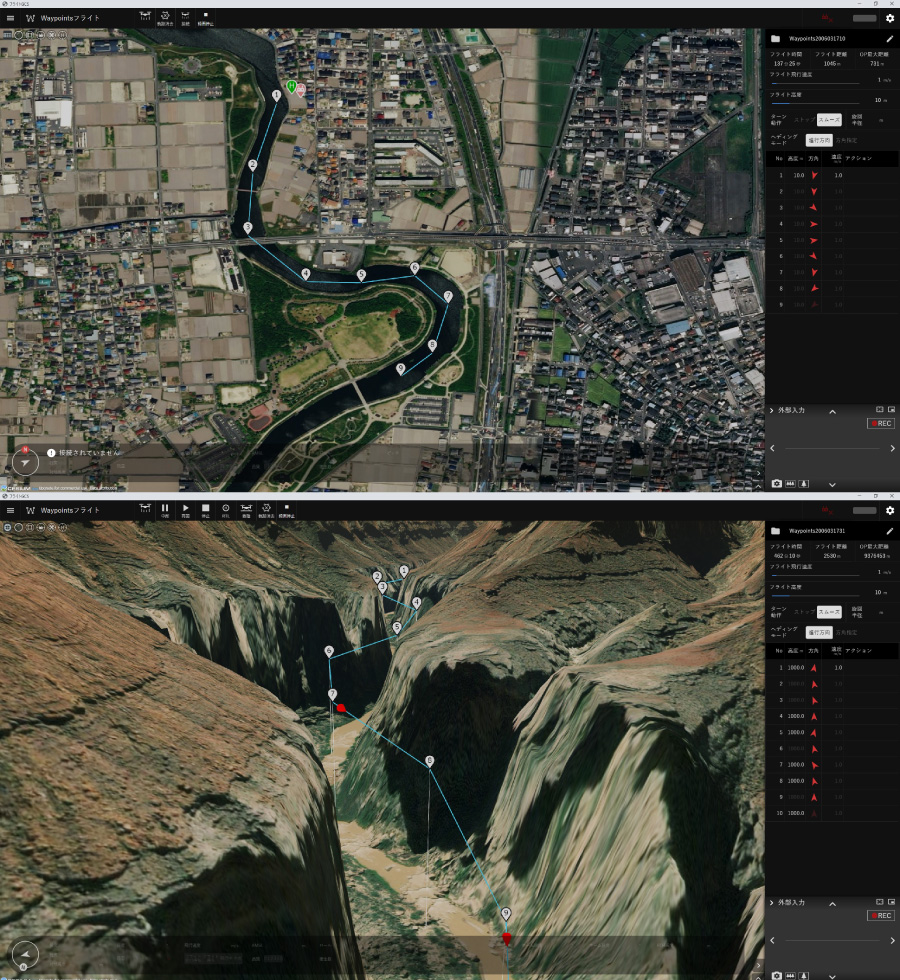
2D / 3D Maps
Supports 2D / 3D Map Display
You can easily switch between 2D mode, which displays maps and aerial photos from above, and 3D mode, which shows maps with elevation data. This allows you to design flight routes tailored to your mission. Maps can be downloaded to PD‑GCS and used offline. 2D map and aerial photo display enables precise horizontal route planning for logistics, surveying, agriculture, and other applications requiring high horizontal accuracy. When flying near terrain or structures where altitude is critical, 3D maps allow intuitive route planning.

AI INTEGRATION
AI Integration (Third‑Party AI Compatible)
PD‑GCS supports seamless integration with various AI analysis engines. From drone‑captured aerial footage, vehicles, people, structural anomalies, and other targets can be automatically detected, recognized, and tracked in real time. This greatly reduces the operator’s visual workload and prevents oversight. It can also flexibly integrate with customer‑developed AI algorithms or third‑party analysis AI, enabling flight operations optimized for specific use cases.
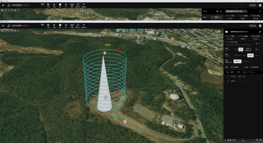
Versatile Autonomy
Autonomous Flight for Diverse Use Cases
You can configure various combinations of flights and repeated flight patterns. Autonomous flight enables inspection of distant buildings as well as patrols and inspections across multiple structures.
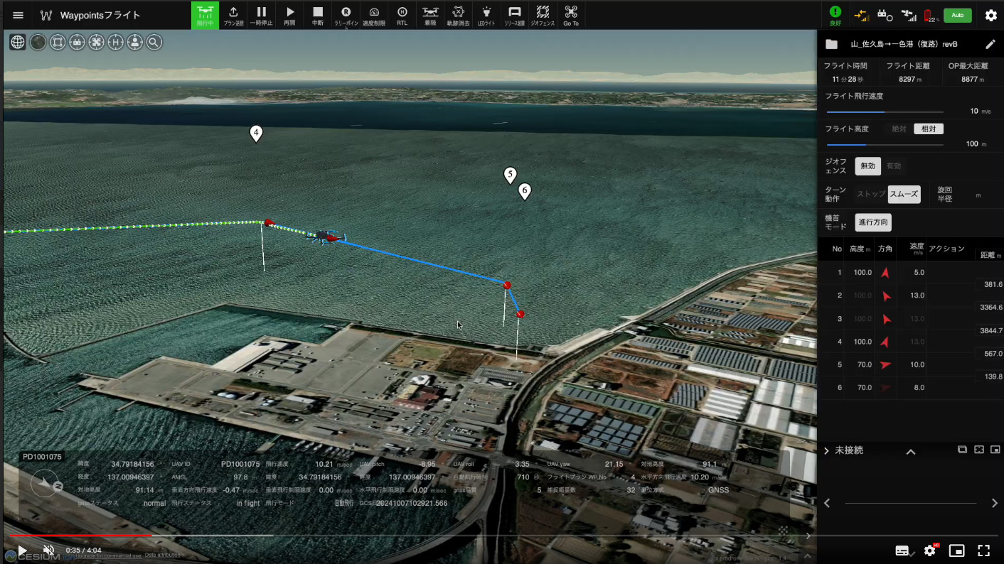
Reporting
Extensive Reporting Features
PD‑GCS displays flight logs organized by flight date and time. Selecting a flight log shows the video and telemetry data recorded at that moment. Telemetry and video are saved and replayed in sync. You can also download log data and video data as needed.
FEATURE OVERVIEW VIDEO
PD‑GCS Feature Introduction & Demo Video
Solutions
 01
01Logistics
Logistics
An Aerial Logistics Revolution Beyond Existing Infrastructure
 02
02Inspection
Inspection
Precision Inspection Where People Cannot Reach
 03
03Surveying
Surveying
High-Precision Data That Accelerates Field Decisions
 04
04Emergency Response
Emergency Response
Rapid First-Response Support in Disasters
 05
05Defense
Defense
Japanese-Built Pride, World-Class Engineering
From inquiry to deployment
Consultation on purchasing / adopting a drone
Start with a consultationHearing on your operations, requirements, and flight environment
Proposal of aircraft and system solutions
Introduction of platform aircraft
Proposal of customized aircraft and software
Defining requirements to match your needs, as needed
Building and tuning the aircraft and software
Prototype build and tuning
Flight verification and testing
Operation training
Before delivery, we provide flight training, maintenance training, safety guidance, software lectures, and more.
Delivery
We deliver the aircraft once you are satisfied through flight verification and other checks.
After-sales support
We provide ongoing support such as periodic updates and regular inspections of the aircraft and software.
On to the Next Mission
Product demos, deployment consulting, partnerships — reach out anytime.
Our dedicated team will respond fast.