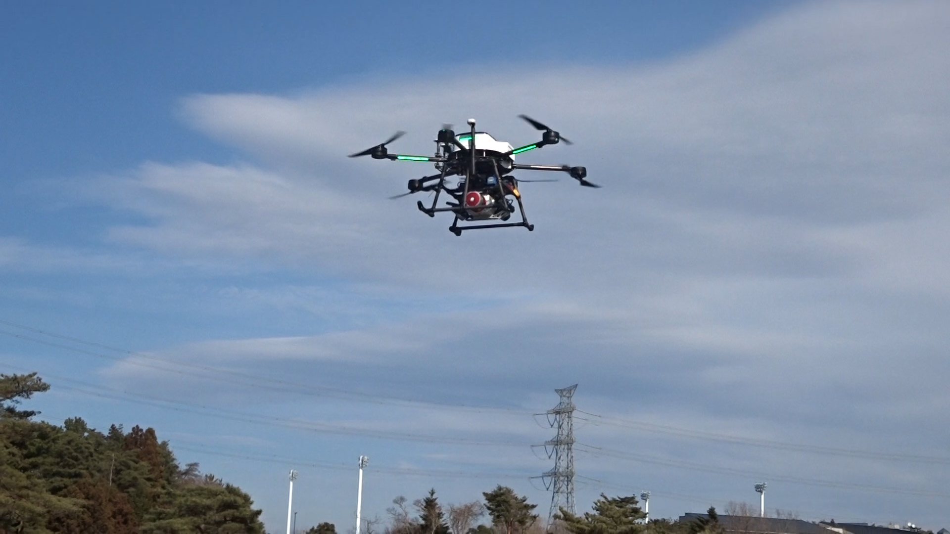
Land surveying with a Riegl laser scanner capable of acquiring high resolution data is based on the stable flight of a large drone. With the cooperation of Owada Surveying and Design Company, our PD6B-Type2 with a RIEGL VUX-1UAV SYS (APX20) laser scanner was used to verify the accuracy. With the maximum payload of 30kg, the PD6B-Type2 completes a survey of 70.000m2 in 3 flights on autopilot with our original GCS.
The PD6B-Type2 performed very well in spite of strong winds of 8mph on the day of the survey, and the surveying flight was completed in three flights. Results of accuracy verification: The accuracy is within 30mm of the standard deviation and the performance is better than 1/250 of the map level.
Measurement Specifications
Altitude: 150m, 100m and 50m
Flight speed: 4m/sec.
Laser pulse rate: 550KHz
 Survey Operation by OWADA SOKURYO SEKKEI, K.K.
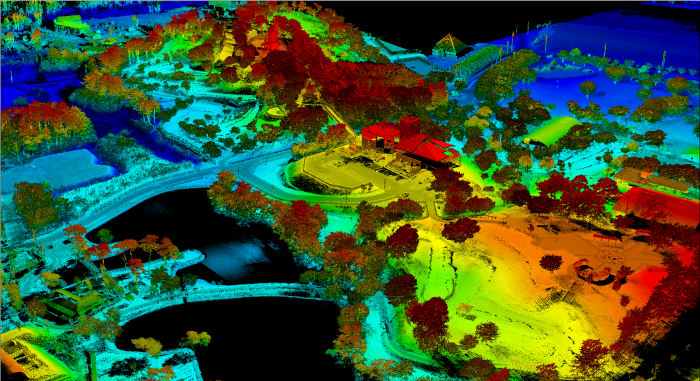 3D point cloud data by Laser Scanner
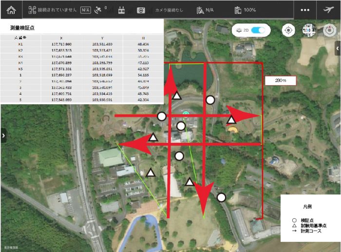 Survey spots
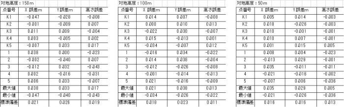 Deviation between survey verification spots and lase scanner points