Cooperated with the “Demonstration experiment to verify data accuracy and improve operability of daytime and nighttime drone laser measurements on natural slopes” conducted by the Fire Research Center.
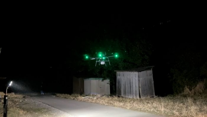
Drone laser measurement at night
PRODRONE Co., Ltd. (Headquarters: Nagoya City, Aichi Prefecture, President and CEO: Shunsuke Totani, hereinafter referred to as PRODRONE) cooperated with the "Demonstration experiment to verify data accuracy and improve operability of daytime and nighttime drone laser measurements on natural slopes (hereinafter referred to as the Demonstration)" conducted by the Fire and Disaster Management Agency's Fire Research Center and Nakanihon Air Service Co., Ltd. in Miyoshi City, Tokushima Prefecture from March 8th to 9th, 2023. The purpose of this demonstration is to collect information (especially measurements at night) during emergencies (disasters) such as landslides and landslides. If it becomes possible to collect information at night at a disaster site, it will not only be possible to manage safety at night, but also to formulate a rescue operation policy starting the next morning, and it can be effectively used to safely search for people in need of rescue and carry out rescue operations. Prodrone also cooperated with the Fire Research Center's night survey verification test in February 2022, assuming a disaster. In this demonstration, we conducted drone laser measurements during the day and night on a natural slope, which is more difficult than on flat ground, and verified the accuracy of the point cloud data obtained from the drone laser.1. OverviewThe flight was conducted over two days from March 8th to 9th, 2023. The drone was flown automatically and manually, and measurements were taken during the day and at night, and the data obtained from each was compared. We received the following comments regarding this verification from Dr. Toshida, Chief Researcher, Earthquake and Disaster Research Laboratory, Technology Research Department, Fire Research Center.
"This demonstration experiment is intended to collect information (especially measurement at night) in emergencies (disasters) such as landslides and landslides.When we conducted it in February 2022, it was a survey on flat land (Fujioka Heliport, Toyota City, Aichi Prefecture). However, this time we are targeting natural slopes with differences in elevation. Also, the natural slopes targeted this time are landslide terrain (terrain where landslides have occurred in the past), and landslide observations are actually being conducted at various universities and research institutes. In this demonstration, we were able to collect information during the day and at night on a natural slope.However, when targeting a natural slope, there is a big problem with the difference in height of the terrain, and it is difficult to fly the drone immediately after arriving at the disaster site without advance preparation. Especially at night, it seems very difficult to fly on the side of a slope.I hope that in the future, objective sensors that can react to overhead wires and functions of drones will become easier, especially for terrain-following flights.
PRODRONE will continue to actively develop aircraft that will be useful in times of disaster while reflecting the voices of the field.
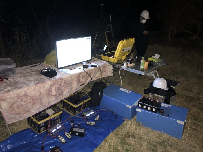
Nighttime experiment scene

PRODRONE GCS setting screen

Check the elevation difference on the Geospatial Information Authority of Japan MAP
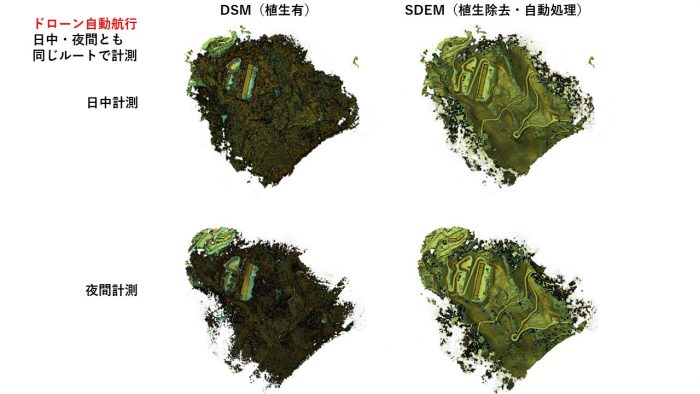
Reference example of point cloud data obtained in this demonstration (provided by Fire Research Center)
*1) DSM (Digital Surface Model) is called a digital elevation model or digital ground model, and is a digital elevation model of the surface layer that combines the ground (topography) and features such as buildings and trees on top of it. *2) SDEM (Substratum Digital Elevation Model) is a model that sharpens the ground surface under vegetation using Nakanihon Airways' proprietary technology.2. Implementation structureFire Research Center (Compilation of demonstration experiments, summary of verification) Nakanippon Aviation Co., Ltd. (Construction of surveying system, accuracy verification) Prodrone Co., Ltd. (Flight cooperation and provision of equipment (generators, etc.))3. Aircraft overview (PD6B-Type3)
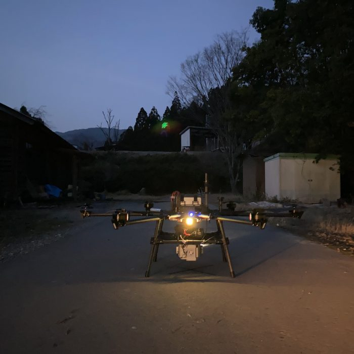
PD6B-Type3 used in demonstration (laser equipment mounted on the bottom)
[Basic specifications] Size: 2,181 mm x 2,398 mm Weight: 20.0 kg (including 4 batteries) Flight time: 20 minutes (4.9 kg installed) Battery: 16,000 mAh x 4 The aircraft used in this demonstration (PD6B-Type3) requires a high level of safety. This is a fully operational drone delivery aircraft that complies with the Ministry of Land, Infrastructure, Transport and Tourism's Flight Permit Application Level 3. It was the first drone in Japan to be used for full-scale operation in the delivery business, and it is currently operating a delivery business in Ina City, Nagano Prefecture. High safety has been achieved through the aircraft design and system redundancy. It offers high adaptability and stable flight with protection class IP44 and forward collision prevention function. The size when stored is less than half the normal size, making it easy to handle.
This article has been automatically translated into English using AI. The original content is written in Japanese. While we strive for accuracy, the translation may not fully capture the nuance of the original.
Related News
Establishment of Prodrone's First Mass Production Plant within Howa Machinery - Notice Regarding Third-Party Allotment of Shares with the Company as the Subscriber -